- GPS & Maps
- Local Maps
- Watchu Mountain Adventure
- Philmont
- Other Resources
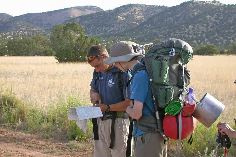
Good navigation skills are |
Good map and compass skills are essential at the Watchu Mountain Adventure and Philmont. While the use of GPS is increasingly popular, it is not necessary but can be a fun learning experience for your crew.
Caution! Use the GPS waypoint information at your own risk - the accuracy of the data cannot be guaranteed by Patriots' Path Council or the Watchu team. Many documents on this site are PDFs that require Adobe Reader. You can download the free software by clicking on the Adobe icon below.
|
- Local hiking trails - A. Klein's map Web site, including
- Mount Allamuchy Scout Reservation
- Schooley's Mountain Park (near Long Valley, NJ)
- Winnebago Scout Reservation
- Watchu Mountain Reservation - map of camp sites and other features
- Hidden Valley Trail - map of the shakedown trail used during the Watchu Mountain Adventure
- Garmin map of Hidden Valley Trail - map of the shakedown trail used during the Watchu Mountain Adventure
- General instructions - Hidden Valley Shakedown Hike
- National Geographic TOPO Data File - to download, right click the link, choose "Save Target As"
- Free New Jersey 24k topo map file for Garmin GPS units
- Free New Mexico 24k topo map file for Garmin GPS units
- GPS Waypoint Data - listings for all Philmont camps and other features (in UTM, datum is WGS 84)
- Overall Philmont Map, North and South segments- determine where camps are located and the trails that connect them. Caution! large files
- GPS Waypoints (PDF file) - for programming all brands of GPS as documented by Philmont
- GPS Waypoints (Excel format) - for programming all brands of GPS
- Garmin GPS Waypoint File - to download, right click the link, choose "Save Target As", unzip the file and then transfer the waypoint data from the PC to your unit. Revised Sept. 2008.
- Magellan GPS Waypoint File - to download, right click the link, choose "Save Target As", unzip the file and then transfer the waypoint data from the PC to your unit
- National Geographic TOPO Data File - to download, right click the link, choose "Save Target As", unzip the file and load on your PC to open with your TOPO software
- Free New Mexico 24k topo map file for Garmin GPS units
- Philmont Geospatial Project - article of recent efforts to provide high-resolution geospatial data of the ranch
- GPS Presentation - how they work plus basic GPS feature and functions
- Orienteering - BSA merit badge requirements
- How To Use A Compass, including exercises to teach others
- Basics of Map and Compass Navigation tutorial
- UTM Map Overlay Tool - print on a plastic transparency film to use with your 1:24000 maps
- GPS Guide For Beginners - an introductory manual from Garmin
- Using A GPS With Maps - a manual from Garmin
- GPS Basics - theory and applications
- GPS Manufacturers - popular brands for outdoor use
- Geocaching - a popular and fun way for learning to use your GPS
- Allamuchy Geocaches - find these locations for GPS navigation practice
- Troop & Crew 445 Arlington, Texas - a great GPS resource with lots of tools and information
- Free downloadable Garmin compatible topo maps for most states including New Mexico